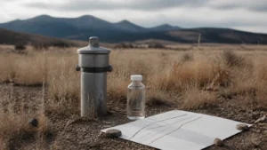
A custom-home site analysis looks at how a proposed home may relate to the specific property—not just how the land appears in a listing photo. Concierge’s public process describes its Site Analysis step as evaluating orientation, views, access, utilities, and constraints. Supporting records and technical reviews depend on the site and the project.
The aim is to bring important site questions into the design conversation early. A checklist or public map can help organize that discussion, but it cannot determine whether a particular property is suitable for a particular home.
What does site analysis mean in the custom-home process?
“Site analysis” can describe different scopes of work. In an active custom-home project, it generally means gathering and reviewing information about the property so the design team can understand opportunities, constraints, and questions that may need further investigation. It is not automatically a survey, geotechnical report, environmental assessment, land-use approval, utility commitment, or construction-price estimate. Those scopes should be identified separately with the responsible professionals.
Concierge places Site Analysis as the second step in its published process, after Discovery and before Design. That supports a project-stage process description; it does not establish a separate pre-purchase lot-review service.
How can orientation and views shape early design questions?
Consider the relationship between the home, the property, and the way the household hopes to use the spaces. Which views matter most? Where should outdoor rooms connect to the interior? Which rooms need particular light or privacy? Are neighboring uses, vegetation, or topographic features important to the conversation?
These questions rarely have one universal answer. Sun exposure, privacy, access, outdoor use, and views can pull a design in different directions. Ask the architect or other responsible design professional to explain the trade-offs for the actual site instead of assuming one orientation is always preferable.
What should you understand about access?
Access means more than drawing a driveway on a sketch. Ask which rights, recorded access documents, physical routes, grades, turning needs, and construction access the team has verified—and which still need confirmation. The applicable authority, road owner, and project documents determine what must be checked for the property.
People, service vehicles, emergency response, deliveries, maintenance, and construction logistics can raise different questions. A visible track, gate, or neighbor’s routine use is not proof of a legal access right or approved route. Ask the appropriate professional or authority to confirm.
Which utility questions belong in the early conversation?
List the services that may matter and identify the evidence behind each assumption. Is a utility line merely nearby, or has the provider confirmed service can be extended to the intended location? Is there a public record for an existing well, and what does that record actually say? Is wastewater expected to connect to a public system, or is a separate system under consideration?
The Colorado Division of Water Resources well-permitting and records page is a useful place to begin looking for well information. A public record does not evaluate a whole property or guarantee the outcome of a future permit decision. Likewise, a utility map is not the same as a provider’s confirmation of capacity, route, cost, or timing.
What site constraints might need specialist input?
Depending on location and proposed design, the team may need to consider terrain, drainage, soils, geologic conditions, flood information, wildfire context, vegetation, easements, access, utilities, or local land-use requirements. Not every property needs the same studies, and a general-purpose map is not a site-specific engineering opinion.
The Colorado Geological Survey hazards resources provide context on topics including landslides, debris flows, earthquakes, and swelling soils. FEMA’s Flood Map Service Center provides official flood-hazard products. These resources can help identify questions for the project team; they do not establish that a parcel is safe, buildable, insurable, or free of constraints.
Planning authority and requirements should be confirmed with the applicable local government. The state’s land-use planning overview is background information, not a jurisdictional determination for an individual property.
What should you ask the project team to clarify?
- Which survey, title, site, or utility records are current, and who prepared them?
- Which boundaries, easements, access rights, or setbacks have been confirmed by the appropriate source?
- What does the team know about orientation, views, terrain, and drainage—and what still needs professional review?
- Which services are available, and which have only been assumed or discussed informally?
- Does a public map or record identify an issue that a qualified specialist should review?
- Which authority decides the relevant land-use, access, or permitting questions?
- Who owns each follow-up, and where will the answer be documented?
If you are evaluating property, our separate Colorado land due-diligence guide covers broader questions. For a project-stage overview, see the Concierge building process. A project Site Analysis should not be confused with a promise of pre-purchase lot review.
Frequently asked questions
Is a custom-home site analysis the same as a survey?
No. A survey is a defined professional product prepared for a particular purpose. Site analysis can refer to a broader review of a property’s relationship to a proposed project. Confirm which records and professional services are included in the scope.
Can a public map tell me whether land is buildable?
No. Maps can help identify context and questions, but they do not provide every parcel-specific answer. Buildability depends on property records, authority decisions, project design, technical findings, and other facts that qualified professionals must evaluate.
Should site analysis happen before I buy land?
The timing and scope of any review depend on the transaction, available access and records, professional scope, and the buyer’s needs. This article does not provide a pre-purchase lot-review service or determine whether a property should be purchased. Discuss transaction timing with your real-estate and legal professionals and site questions with qualified technical professionals.
Who can answer a site-specific technical question?
It depends on the question. A surveyor, geotechnical or civil engineer, utility provider, water professional, land-use authority, or other qualified specialist may be needed. Ask the project team to identify the responsible person and the limits of their scope.
When you are ready to discuss Concierge’s publicly described process, book a Discovery Call.
Educational information only. This article is not legal, engineering, geotechnical, survey, land-use, water, utility, insurance, or real-estate advice. Confirm property-specific conditions and requirements with the appropriate authority and qualified professionals.