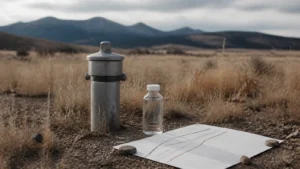
A Colorado geotechnical report can describe the soil and bedrock encountered at specific test locations, identify conditions such as expansive or collapsible materials, record groundwater observations, and provide recommendations relevant to foundations, slabs, earthwork, and drainage. Its value depends on the investigation scope, the proposed homesite, and interpretation by qualified design professionals.
The most important part of a homesite is often the part no one can see.
A parcel may feel calm and uncomplicated from the surface. Beneath it, soil, bedrock, moisture, and past site disturbance can influence where a home sits, how the structure is designed, how water moves around it, and how the property is prepared for construction.
That does not mean a technical finding makes land “good” or “bad.” It means the land is beginning to explain what it needs.
For someone considering a custom home, a well-scoped geotechnical investigation can turn an invisible condition into a design conversation before too many assumptions harden around the home.
This article is educational. A qualified geotechnical engineer and the other licensed or qualified professionals responsible for the project should define the investigation, interpret the findings, and make design recommendations for the specific site.
What is a soils report for a custom home?
“Soils report” is the phrase many buyers and builders use in everyday conversation. The document is generally the result of a geotechnical investigation: a professional evaluation of subsurface conditions for a defined site, project, and purpose.
The engineer may review existing information, observe the site, arrange borings or other exploration, test selected samples, and prepare findings and recommendations. The exact work varies. A report for an early land decision may have a different scope from one prepared for final structural design, grading, a long driveway, a retaining wall, or another improvement.
The report should make its purpose and limits clear. Useful questions include:
- Which proposed structures and site improvements were considered?
- Where did the subsurface exploration occur?
- What materials and conditions were encountered at those locations?
- Which laboratory or field tests were completed?
- Which recommendations apply to foundations, slabs, earthwork, drainage, pavement, or other work?
- What was outside the investigation’s scope?
- What additional work may be needed as the design becomes more specific?
A report is most useful when the question behind it is equally clear. “Tell us about the dirt” is broad. “Help the project team understand conditions at this proposed homesite and driveway” gives the investigation a more meaningful relationship to the decisions ahead.
Is a soils report a pass-or-fail test for land?
No. A geotechnical report is better understood as a design input than a pass-or-fail certificate.
Some findings may require more investigation or may introduce serious feasibility concerns. Others may simply change the engineering approach, site plan, drainage strategy, construction sequence, or working allowance. The significance depends on the home, the precise building area, the jurisdiction, and the recommendations of the responsible professionals.
The report also does not guarantee that every subsurface condition has been found. Exploration offers information at particular locations and depths. Conditions between those locations can differ. Groundwater observations reflect what was encountered during the investigation and may not describe every seasonal or long-term condition.
The right response is not to reduce the report to one word. It is to ask what the findings mean for this home, on this site, at this stage of design.
Can the USDA Web Soil Survey tell you whether a lot is buildable?
The USDA NRCS Web Soil Survey is a useful mapped-data screening tool. USDA guidance on understanding soil risks and hazards also helps explain why mapped information has limits. Neither resource replaces site investigation, local requirements, or engineering judgment.
An early desktop review can include the USDA Natural Resources Conservation Service Web Soil Survey. It provides official soil-survey data and interpretations for a selected area of interest, helping buyers become familiar with mapped units, properties, and possible land-use limitations before parcel-specific work begins.
It is a screening resource, not a final homesite investigation.
NRCS states that soil surveys are not designed for site-specific evaluations or as complete prescriptions for the design and construction of a specific project. A mapped unit can contain variation, and a regional soil survey does not replace field exploration, laboratory testing, engineering judgment, or the requirements of the local jurisdiction.
Use Web Soil Survey to ask better questions. Do not use it to declare that a foundation, basement, driveway, or homesite is approved.
What may a Colorado geotechnical investigation reveal?
Colorado Geological Survey land-use review guidance provides broader context for geologic review and reports. The project engineer defines the actual scope and recommendations; this guidance does not approve the land.
The content and terminology of a report depend on its scope. The following decision table shows common topics and why they may matter to a custom-home team.
| Report topic | Question it may help answer | Possible project conversation | Lead interpreter |
|---|---|---|---|
| Soil and bedrock profile | What materials were encountered at the explored locations and depths? | Homesite placement, excavation assumptions, earthwork, and whether the current exploration supports the developing concept. | Geotechnical engineer, with input from relevant design professionals. |
| Expansive or collapsible conditions | Do tested materials show a tendency to swell when wetted, or settle under certain wetting and loading conditions? | Structural and slab coordination, moisture management, earthwork, landscaping, and long-term drainage. | Geotechnical and structural engineers within their respective scopes. |
| Bedrock | Was bedrock encountered, at what explored depth, and how was it described? | Excavation, utility trenches, lower-level assumptions, bearing conditions, and the need for further exploration. | Geotechnical engineer, with civil, structural, and construction teams as appropriate. |
| Groundwater observations | Was groundwater observed during the investigation, and what limitations apply to that observation? | Drainage, excavation, basement assumptions, dewatering considerations, and whether longer observation or additional work is recommended. | Geotechnical and civil engineers and other qualified professionals as the site requires. |
| Engineering recommendations | What design and construction considerations follow from the investigated conditions? | Foundation and slab design, grading, earthwork, drainage, pavements, retaining structures, and construction observation. | The engineer who prepared the report, followed by the licensed professionals responsible for each design element. |
| Limitations and additional work | Which uncertainties remain, and when should the engineer return to the project? | Further exploration, design-phase updates, excavation observations, material testing, and response to conditions that differ from the report. | Geotechnical engineer and project team. |
The table is intentionally framed as a conversation. A report does not design the home by itself. It gives the responsible team information and recommendations to carry into design and construction.
What is expansive soil?
Colorado Geological Survey guidance on expansive soil and rock provides general hazard context. It does not identify parcel conditions, severity, design response, feasibility, or cost.
Expansive soil and rock contain clay materials that can increase in volume when wetted and shrink as they dry. The Colorado Geological Survey identifies expansive soil and rock as a significant geologic hazard in the state and advises relying on qualified professionals to identify and evaluate it.
For a land buyer, the practical point is not to diagnose clay by appearance or assume every clay-bearing site behaves the same way. The type, extent, moisture conditions, tested behavior, loading, drainage, and proposed improvements all matter.
If expansive conditions are identified, the project team may need to coordinate the structure, slabs, earthwork, drainage, utility connections, hardscape, irrigation, and long-term moisture management around the engineer’s recommendations. The correct response is site-specific. This article does not recommend a foundation system.
What is collapsible soil?
Colorado Geological Survey guidance on collapsible soils provides general land-development hazard context. It does not diagnose the parcel or predict settlement, design, schedule, or cost.
Collapsible soils can undergo settlement when particular soil structures are loaded or wetted. The Colorado Geological Survey describes them as a land-development hazard found in multiple areas of the state, with the potential to affect foundations, slabs, pavements, utilities, and other improvements when not properly evaluated and addressed.
Expansive and collapsible are not interchangeable terms. One involves swelling behavior; the other involves settlement or collapse. A site may also present other conditions entirely. Only appropriate investigation and professional interpretation can establish what is relevant to a particular parcel.
The distinction matters because a generic statement such as “the soil is difficult” tells the design team very little. A clear report identifies the observed or tested condition, explains its significance within the report’s scope, and provides recommendations for the project team to consider.
What do bedrock and groundwater observations mean?
Bedrock is not automatically a benefit or a problem. Its material, condition, depth, orientation, weathering, and variability may influence excavation, bearing, utility work, drainage, or the need for more exploration. A report should be read for what was actually encountered rather than for a broad assumption about “rock.”
Groundwater deserves the same care. An observation in a boring records conditions at a particular place and time. It may be influenced by recent weather, season, irrigation, snowmelt, perched water, drainage, or other factors. A note that groundwater was not observed is not necessarily a promise that it will never be present. A note that it was observed does not, by itself, define its long-term level or every design response.
Ask the engineer what the observation means, what it does not mean, and whether further monitoring or analysis is appropriate for the proposed home.
How can the findings shape a custom-home concept?
The report becomes valuable when its findings are translated across the project rather than filed away as a permit attachment.
Depending on the recommendations and the developing design, it may inform conversations about:
- The most appropriate area for the home and major site improvements.
- Foundation and floor-system coordination by the responsible engineers.
- Whether a lower level remains consistent with the site and project goals.
- Excavation, fill, compaction, moisture conditioning, and material reuse or removal.
- Surface drainage, subsurface drainage, and water management around the home.
- Driveways, patios, terraces, retaining structures, pools, and detached buildings.
- Utility trenches and transitions between the home and surrounding ground.
- Landscaping and irrigation near improvements.
- Construction observation, testing, and responses to conditions exposed during excavation.
- Which site allowances should remain provisional until design and investigation are more complete.
This is where an integrated team matters. The geotechnical engineer explains the subsurface findings and recommendations. The architect, structural engineer, civil engineer, landscape team, builder, and other professionals then address those recommendations within their own work.
Why should the proposed homesite be considered before testing?
On a generous parcel, there may be several places where the home could sit. Those areas may not have identical subsurface conditions.
Testing far from the eventual building pad can still add knowledge, but it may not answer the project’s central question. The same applies to a neighboring lot’s report or a report prepared for an earlier design. It can provide context without becoming a substitute for work scoped to the current parcel and improvements.
Before exploration begins, share the best available site information with the geotechnical engineer:
- The preliminary home location and approximate footprint.
- The possibility of a basement or stepped foundation.
- The driveway approach and major grade changes.
- Retaining walls, pools, detached structures, or other significant improvements under consideration.
- Existing drainage, slopes, cuts, fills, or signs of past disturbance.
- Survey and topographic information that is available.
- Known local requirements and the current design stage.
The engineer should determine the appropriate exploration plan. The buyer’s role is to make sure the professional is investigating the decision the team intends to make.
What should you ask the geotechnical engineer?
Bring these questions to the report review:
- What project assumptions and proposed improvements did you use?
- Where was exploration performed, and what was the reasoning behind those locations?
- What did you observe or test, and where could conditions vary?
- Which findings most directly affect the current home and site concept?
- Which recommendations belong with the architect, structural engineer, civil engineer, landscape team, or builder?
- Which recommendations apply to drainage and moisture management during and after construction?
- Are additional borings, tests, observations, or design-phase updates recommended?
- What conditions during excavation should trigger a call back to your team?
- Are any conclusions dependent on assumptions that have not yet been confirmed?
- What does this report not evaluate?
A strong review should leave the team with clear owners and next steps, not simply a list of technical terms.
How should you use the report before deciding on land?
First, have the report explained by the professional who prepared it. Then bring its recommendations into the preliminary site, design, schedule, and budget conversations.
Separate the outcome into three groups:
- Feasibility questions that remain unresolved and require more work.
- Design conditions the team can responsibly address.
- Scope, allowance, or timing implications that should be carried forward rather than treated as fixed pricing.
Do not ask a preliminary report to provide a guaranteed construction number. A site allowance is only as reliable as the design, investigation, quantities, assumptions, and market information behind it. If the land is under contract, review the technical findings and remaining uncertainty with your attorney and other advisers before the applicable deadline.
Colorado Soils Report Review Checklist
- The report identifies the parcel, proposed project, purpose, and date.
- The proposed homesite and major improvements used for the investigation are clear.
- Exploration locations and depths are documented.
- Field and laboratory work included in the scope is identified.
- Soil, bedrock, and groundwater observations are described with appropriate limitations.
- Expansive, collapsible, settlement, slope, or other relevant concerns are addressed if within scope.
- Recommendations are organized for the design and construction professionals who must use them.
- Drainage and moisture-management recommendations are understood.
- Additional investigation, design updates, observation, and testing requirements are assigned.
- Findings have been reconciled with the preliminary site plan, design goals, schedule, and working allowances.
- Unresolved conditions and report assumptions are documented.
- The buyer’s professional advisers have reviewed the decision before the contractual deadline.
Frequently Asked Questions
Is a soils report the same as a geotechnical report?
People often use “soils report” as a convenient name for a geotechnical report. A geotechnical investigation may consider soil, bedrock, groundwater observations, earthwork, drainage, and engineering recommendations, depending on the agreed scope. Read the report’s stated purpose rather than relying on its informal name.
When should a land buyer commission site-specific geotechnical work?
Timing is parcel- and project-dependent. The proposed home, likely building area, known site conditions, local requirements, contract deadlines, and professional advice all affect when useful investigation can occur. Ask a qualified geotechnical engineer and your other advisers to define the work needed for the decision at hand.
Can a neighboring lot’s report be used for my parcel?
A neighboring report may offer regional context, but it does not establish conditions beneath your proposed home. Soil, fill, bedrock, moisture, slope, and past disturbance can vary over short distances. Ask a qualified engineer what parcel-specific work is appropriate.
Does a soils report tell me exactly what the foundation will cost?
No. The report provides findings and recommendations within its scope. Actual foundation and site costs also depend on the design, structural solution, quantities, access, construction plan, market conditions, and contractor pricing. Avoid turning preliminary technical information into a guaranteed number.
Can Web Soil Survey replace onsite testing?
No. Web Soil Survey provides official mapped soil data and useful screening information. NRCS states that soil surveys are not designed for site-specific evaluation or complete project prescriptions. The appropriate field exploration, testing, and engineering judgment must be defined for the parcel and proposed improvements.
What does an observation of groundwater in a boring mean?
It records what was observed at a particular location and time under the investigation conditions. Groundwater may vary by season, weather, irrigation, drainage, and local geology. The engineer should explain the observation’s limitations and whether additional monitoring or design coordination is warranted.
Read the Land Before Asking It to Hold the Home
The purpose of a soils report is not to make the land feel more complicated. It is to replace a hidden assumption with a more deliberate choice.
When the subsurface information, architecture, engineering, site plan, and construction thinking are brought together early, the home has a better chance to feel as though it belongs exactly where it stands.
The land and the home should be considered together. Get the free Buying Land in Colorado guide for a broader due-diligence checklist. When you are ready to discuss the home itself, book a Discovery Call with Concierge Custom Homes.