Before buying land in Colorado for a custom home, verify what can legally be built, how the home and emergency vehicles will reach the site, whether water and wastewater are feasible, what the soils and terrain require, how utilities will be delivered, and which hazards or recorded restrictions affect the design. Complete those checks while your contract still protects your options.
The right piece of land should feel inspiring. It should also work quietly behind the scenes.
Views, privacy, mature trees, and open space are often what make a parcel memorable. Buildability is what determines whether that parcel can support the home, experience, budget, and timeline you imagined. In Colorado, two lots that look equally beautiful can ask very different things of a project once access, geology, water, wastewater, utilities, drainage, and local land-use rules are understood.
Good due diligence does not remove every unknown. It turns the most important unknowns into decisions you can make with your eyes open.
This guide is educational and does not replace advice from a Colorado real estate attorney, land specialist, surveyor, engineer, water professional, local planning department, or other qualified professional familiar with the parcel.
What makes Colorado land truly buildable?
A buildable parcel is not simply land large enough to hold a house. It is land where your intended home can be approved, positioned, reached, serviced, engineered, and constructed without conflicts you did not plan for.
That answer comes from several layers of information:
- Land-use fit: The jurisdiction allows the intended residential use, and the concept can comply with setbacks, height limits, lot coverage, overlays, and other applicable rules.
- Recorded-property fit: Title documents, easements, covenants, and the survey do not create an unresolved conflict with the homesite, driveway, utilities, privacy, or future uses that matter to you.
- Physical fit: The slope, soils, bedrock, groundwater conditions, drainage, and natural hazards can be addressed through a responsible design and engineering approach.
- Infrastructure fit: The site has a feasible path for legal and physical access, water, wastewater, power, communications, fuel, and emergency response.
- Project fit: The cost and time required to solve those conditions still leave room for the home and level of finish you want.
The most useful question is therefore not, “Can someone build here?” It is, “Can this land support our home, our priorities, and our complete project?”
What should you check before becoming attached to a parcel?
Begin with a fast screen before investing heavily in design or technical reports. The goal is not to approve the land from a distance. It is to find obvious conflicts early and decide which parcels deserve deeper investigation.
Start with the correct local authority. A mailing address does not always tell you which city, town, county, special district, fire district, or health agency controls a particular decision. Confirm the parcel number and jurisdiction first.
Then ask:
- What is the current zoning, and is a single-family residence allowed as proposed?
- Are there setbacks, height limits, lot-coverage limits, ridgeline rules, design standards, or overlay districts that affect the concept?
- Is the parcel governed by an owners association, architectural review committee, or recorded private covenants in addition to public rules?
- Is there recorded legal access, and does the existing physical route match it?
- Is the likely building area affected by steep slopes, drainageways, mapped flood hazards, wildfire requirements, unstable ground, or other geologic concerns?
- Is the parcel served by public water and sewer, or will it depend on a well, cistern, onsite wastewater treatment system, or another approved solution?
- Where are power and communications located, and what would it take to extend them to the likely homesite?
- Does the parcel appear large enough only on paper, or is there a practical building envelope after restrictions and site conditions are placed on the same plan?
Online maps are useful screening tools, but they are not a final site investigation. Parcel boundaries shown in a county viewer may not replace a survey. A soil map may not describe conditions at the exact building pad. A utility line near the road may not mean service is available at the capacity or cost the project needs.
Which due-diligence findings can change a custom-home plan?
The table below is designed to keep the investigation connected to the home. Each item matters because it can change the building area, architecture, engineering, site work, schedule, or long-term ownership experience.
| Due-diligence area | What to verify | Who should confirm it | Possible project effect |
|---|---|---|---|
| Land use and permits | Allowed use, setbacks, height, lot coverage, overlays, design review, and permit path | Local planning and building departments; land-use counsel when needed | Building envelope, massing, approvals, schedule |
| Title and private restrictions | Ownership, recorded easements, covenants, encumbrances, and rights that affect use | Title company and Colorado real estate attorney | Homesite, driveway, utilities, privacy, future structures |
| Boundary and topography | Legal boundaries, corners, contours, improvements, and encroachments | Licensed surveyor | Siting accuracy, grading, retaining, access |
| Legal and physical access | Recorded access, road ownership, maintenance, width, grade, winter conditions, and emergency requirements | Attorney, surveyor, road authority, fire authority, and civil engineer as appropriate | Driveway design, maintenance, response access, site-work scope |
| Soils and geology | Soil profile, expansive or collapsible materials, bearing conditions, bedrock, groundwater indicators, slope stability, and report recommendations | Colorado-licensed geotechnical engineer and other qualified design professionals | Foundation concept, excavation, drainage, design coordination |
| Water | Public tap availability or private-well permit path, allowable uses, existing records, physical condition, yield information, and water quality | Utility provider or Colorado Division of Water Resources; well and water-quality professionals | Household use, irrigation or accessory uses, equipment, schedule |
| Wastewater | Sewer availability or onsite system feasibility, local review, design area, setbacks, and reserve-area requirements | Sewer provider or local public health agency; qualified OWTS professional | Site plan, bedroom assumptions, system design, ongoing care |
| Utilities | Location, capacity, easements, extension route, transformer or equipment needs, and provider lead times | Each utility provider and project team | Trenching, equipment, schedule, landscape disturbance |
| Drainage and flood | Effective flood information, drainage paths, erosion, culverts, stormwater requirements, and finished-floor implications | FEMA resources, local floodplain administrator, civil engineer | Homesite elevation, access, grading, drainage design |
| Wildfire | Wildland-urban interface conditions, local mitigation requirements, water supply for fire response, access, and home ignition zone planning | Local fire authority and Colorado State Forest Service guidance | Siting, materials, vegetation work, access, maintenance |
The value of this table is not the number of reports collected. It is the conversation among them. A technically possible driveway may disturb the best septic area. The ideal view corridor may place the house closer to a steep slope. A long utility route may cross an easement or require additional clearing. Buildability is an integrated answer.
How do zoning, easements, and covenants shape the home?
Public rules and private restrictions are separate layers. Passing one does not mean the parcel passes the other.
The local planning department can explain the zoning and public review path. A title commitment and recorded documents can reveal access easements, utility easements, conservation restrictions, shared-road obligations, or private covenants. An owners association or architectural committee may add design requirements beyond the jurisdiction’s rules.
Ask the project team to place the known restrictions on one current survey or site plan. That is when an abstract list of setbacks and easements becomes a visible building envelope.
Questions worth resolving include:
- Where can the main home legally and practically sit?
- Is there room for the driveway, grading, wastewater area, utilities, drainage, outdoor living, and any future structures?
- Do easements cross the most desirable part of the site?
- Are there architectural restrictions that conflict with the intended style, materials, roof form, or visibility of the home?
- Are there obligations for shared roads, gates, snow removal, drainage, or private infrastructure?
These are legal and land-use questions. They should be reviewed by the appropriate professionals rather than inferred from a listing description.
Why are legal access and physical access different?
A visible road does not by itself prove a permanent right to use it. Conversely, a recorded access right does not guarantee that the route is ready for construction traffic, year-round living, or emergency vehicles.
A complete access review considers both documents and ground conditions:
- Is access recorded, and does the survey show where it lies?
- Who owns and maintains the road?
- Is there a written maintenance agreement or shared obligation?
- Can the route meet applicable width, grade, turning, bridge, culvert, and emergency-access standards?
- What happens in snow, heavy rain, wildfire conditions, or seasonal closures?
- Can construction equipment reach the building area without an unexpected temporary road or major disturbance?
Access is part of the home experience. A private mountain road may be exactly what creates the sense of arrival and seclusion a client wants. It should simply be understood as an operating and design commitment, not treated as a line already solved on a map.
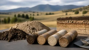
What can soils and geology tell you before closing?
Colorado Geological Survey land-use and geologic-hazard guidance explains why geologic conditions can change over a short distance. Expansive soil and rock, collapsible soils, shallow or variable bedrock, groundwater, unstable slopes, rockfall, and other hazards can influence how a site is designed and built.
The USDA Natural Resources Conservation Service Web Soil Survey is useful for an early, broad look at mapped soil information. It is not a substitute for parcel-specific investigation and engineering.
A geotechnical investigation can help the design team understand the materials beneath a proposed building area and provide recommendations for the project. Depending on the scope and site, the report may address:
- Soil and bedrock encountered in the borings or test locations.
- Moisture and groundwater observations at the time of investigation.
- Expansive, collapsible, compressible, or otherwise challenging materials.
- Engineering parameters and recommendations relevant to foundations, slabs, earthwork, drainage, and pavement.
- Additional investigation or construction observation the engineer considers necessary.
The Colorado Geological Survey advises relying on qualified professionals to identify expansive-soil hazards. A report should therefore be read as professional guidance tied to its locations, assumptions, and limitations, not as a simple pass-or-fail certificate.
Before the investigation is ordered, the likely homesite matters. Testing one corner of a large parcel may not answer the questions beneath a different building pad. Coordinate the preliminary site concept with the geotechnical engineer so the scope serves the decision you are actually making.
How should you evaluate water and wastewater?
First determine whether the parcel is served by public or private systems. Then confirm the path in writing with the authority or provider responsible for it.
For a public system, ask whether a tap or connection is available to this parcel, where the infrastructure is located, what capacity and design requirements apply, and which fees and extensions remain the owner’s responsibility.
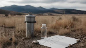
For a private well, the Colorado Division of Water Resources well-permitting resources explain the state permit role and provide tools for researching registered wells. Existing permit files may include allowable uses, the original application, and available construction or pump-installation records. Those records are valuable, but they do not replace confirmation of the parcel’s current permit path, the physical condition of a well, available yield information, or water-quality testing.
Private-well water quality is not regulated like a public drinking-water system. Colorado public-health guidance for private wells places responsibility for testing on the well user. Testing plans should be discussed with an accredited laboratory and the appropriate water professional; Colorado water-testing services provide current state context.
For onsite wastewater, Colorado’s Regulation 43 provides the statewide framework, while local public health agencies generally permit residential systems at typical household flows and may adopt requirements that are more protective. Contact the correct local agency before assuming that acreage, a preliminary soil map, or a listing’s reference to “septic available” establishes feasibility.
The wastewater review should account for the proposed home, site conditions, required setbacks, the soil treatment area, any required reserve area, wells and water features, slopes, and local design standards. Protecting enough suitable land for the system can be as important as finding the homesite itself.
Which site conditions can quietly expand the project scope?
Land cost is only one part of the property decision. Site development is the work required to make the homesite accessible, stable, serviced, drained, and ready for the home.
Before comparing parcels, look at the likely scope of:
- Clearing and selective tree removal.
- Cut, fill, excavation, rock removal, and soil export or import.
- Retaining walls and slope stabilization.
- Driveway length, grade, surfacing, culverts, turnouts, and snow management.
- Utility trenching, equipment, extensions, easements, and provider lead times.
- Well, water storage or treatment, sewer connection, or onsite wastewater work.
- Drainage, erosion control, stormwater measures, and floodplain requirements.
- Wildfire mitigation, defensible space, fire-resistant design considerations, and emergency access.
- Construction staging, material delivery, and equipment access.
- Restoration and landscape work after site construction.
Do not assign universal premiums to “mountain,” “foothills,” or “plains” land. A gentle mountain parcel with existing infrastructure may be simpler than a plains parcel with expansive soils and a long utility extension. Compare the actual conditions and written assumptions for each property.
Use the FEMA Flood Map Service Center as an official starting point for flood-map research. A map layer alone does not establish complete drainage, erosion, access, elevation, insurance, or design conclusions.
Use Colorado State Forest Service wildfire-mitigation guidance to frame early questions about the home and property. It does not establish parcel hazard, code compliance, fire-authority approval, insurability, or a mitigation design.
How do you turn due diligence into a confident decision?
Organize the findings into three groups.
Group 1: Unresolved feasibility issues
These are questions that may justify pausing, extending the investigation if the contract allows, renegotiating terms with professional advice, or deciding the parcel is not the right fit. Examples may include unresolved legal access, a use that is not allowed as intended, or a water or wastewater path that has not been established.
Group 2: Design constraints
These conditions do not necessarily make the parcel unsuitable. They shape the solution. A smaller building envelope, a protected view corridor, a different driveway approach, a no-build easement, or a foundation recommendation may ask the architecture to respond more deliberately.
Group 3: Budget and schedule assumptions
These are feasible items that need a realistic allowance, owner decision, or lead-time plan. Utility extensions, retaining, rock excavation, an engineered wastewater system, or wildfire work belong in the complete project conversation rather than outside the home budget.
Ask the team to summarize the parcel in one integrated feasibility record. It should identify what is verified, what is assumed, what remains open, who owns each next step, and when each answer is needed. That record is more useful than a folder of reports no one has reconciled.
What is the recommended order for Colorado land due diligence?
- Confirm the parcel, jurisdiction, intended use, and obvious land-use conflicts.
- Review title, recorded documents, legal access, covenants, and available survey information with the appropriate professionals.
- Develop a preliminary site concept showing the likely home, driveway, utilities, wastewater area, drainage, and important outdoor uses.
- Scope parcel-specific investigations for surveying, soils, geology, water, wastewater, drainage, flood, wildfire, and other relevant conditions.
- Obtain utility and infrastructure information from the responsible providers and agencies.
- Bring the findings back to the design and construction team so they can identify design implications, allowances, timing, and remaining uncertainty.
- Review the complete decision with your real estate attorney and other advisers before the contractual deadline.
How should a land buyer use the due-diligence period?
Use the due-diligence period to organize the questions that could change the land decision, obtain parcel-specific information from the responsible agencies and professionals, and review unresolved matters with your advisers before the contractual deadline. The right scope depends on the property, the intended home, and the terms of the contract.
Concierge Custom Homes can be part of the conversation once you are ready to discuss the home you hope to create. This article does not establish legal buildability, guarantee affordability, replace a contract contingency, or replace the attorneys, surveyors, engineers, water and wastewater professionals, and local authorities responsible for parcel-specific decisions.
Colorado Custom-Home Land Checklist
Use this list as a conversation guide. The right scope depends on the parcel and jurisdiction.
- Parcel number and governing jurisdiction confirmed.
- Intended residential use and local review path confirmed.
- Setbacks, overlays, height, lot coverage, and design rules reviewed.
- Title commitment, easements, covenants, and encumbrances reviewed.
- Boundary, topographic, and encroachment survey needs established.
- Legal and physical access reviewed, including maintenance and emergency requirements.
- Preliminary homesite, driveway, utilities, drainage, and wastewater areas tested together.
- Geotechnical and geologic investigation scoped for the proposed building area.
- Public water and sewer availability confirmed, or private well and onsite wastewater paths investigated.
- Power, communications, fuel, and extension responsibilities confirmed with providers.
- Effective flood information and site drainage reviewed.
- Wildfire conditions, mitigation expectations, and emergency access reviewed.
- Site-work scope and construction logistics discussed with qualified professionals.
- Open items, assumptions, allowances, and decision deadlines documented.
- Contract and legal questions reviewed by a Colorado real estate attorney.
Frequently Asked Questions
What is the most important due diligence before buying land to build in Colorado?
There is no single test that establishes buildability. The essential work is to confirm land use, title and access, the practical building envelope, soils and geology, water and wastewater, utilities, drainage and flood conditions, wildfire considerations, and the site work needed to connect them. The findings should be reviewed together, not as isolated checkboxes.
Should I get a soils report before buying Colorado land?
For many custom-home parcels, a parcel-specific geotechnical investigation is an important part of pre-purchase evaluation. The appropriate scope depends on the proposed homesite, jurisdiction, geology, and project. A qualified geotechnical engineer familiar with applicable Colorado requirements should define the work and explain the report’s recommendations and limitations.
Can the USDA Web Soil Survey replace a geotechnical report?
No. The Web Soil Survey is a useful screening resource for mapped soil information. It does not replace borings, field observations, laboratory testing, engineering judgment, or a site-specific report prepared for the proposed project.
Does a larger parcel automatically have fewer building restrictions?
No. Acreage alone does not establish zoning compliance, legal access, water or wastewater feasibility, freedom from easements or covenants, or a suitable building area. Local rules and parcel-specific conditions still need to be verified.
How long should a land due-diligence period be?
There is no universal period for Colorado land. The timeline is a negotiated contract term and should reflect the investigations, agency responses, professional availability, and parcel complexity involved. A Colorado real estate attorney and land-specialist broker can help structure and monitor the dates.
Does an existing well permit guarantee the water I need?
No. An existing permit file can show allowable uses and may include construction or pump records, but it does not by itself answer every question about current status, physical condition, yield, water quality, or whether the intended use is permitted. Confirm each issue with the responsible agency and qualified professionals.
Is a mountain lot always more expensive to develop than a plains lot?
No. Terrain labels are only a starting point. Slope, rock, soil behavior, access, utility distance, water and wastewater, drainage, wildfire work, and construction logistics determine the actual site scope. Compare specific parcels using the same checklist and current professional input.
A More Considered Beginning
The land is the first design decision, even before a line of the home is drawn. When it is evaluated with the same care as the architecture, it can do more than hold the house. It can shape privacy, arrival, light, views, outdoor living, and the quiet rhythm of daily life.
Want a practical companion for the decisions ahead? Get the free Buying Land in Colorado guide. If you are considering property in Colorado and are ready to talk about the home you hope to create, book a Discovery Call with Concierge Custom Homes.